AirfieldpathOrlando Sanford International

2.22 · Proof of concept · Connect

Sensors on the Map Real

Every sensing point at its place; click one for its quick look, its views and anything the twin wants to ask.

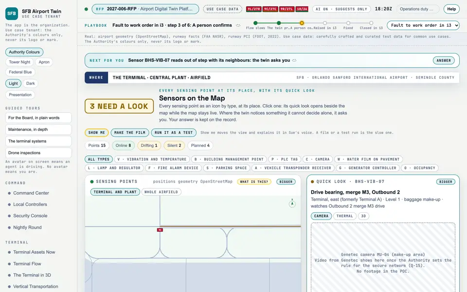
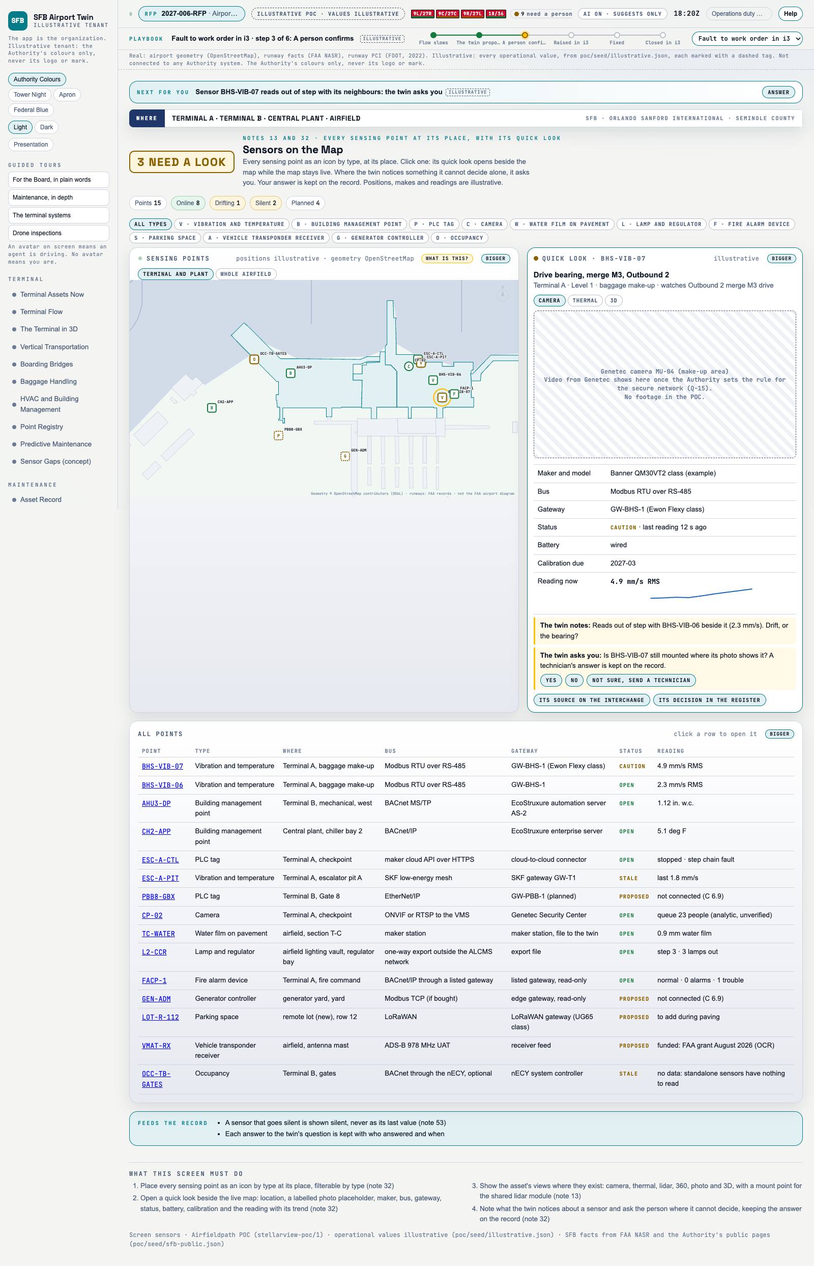
Picture: Headless capture of poc/index.html?v=sensors&m=light, as the proof of concept renders it, 1400 by 875 at 2x scale.

Screen · Proof of concept · Connect

Sensors on the Map

Every sensing point at its place; click one for its quick look, its views and anything the twin wants to ask.

  1. Sources
  2. Interchange
  3. Twin
  4. Screens
  5. Plan
Kind
Screen
Status
not linked
Airport layer
Screens: the POC story and the spines
Airport area
not linked
System
not linked
Sensor type
not linked

Open the screen · Open the detail

Level 2 of 3 This component, complete on its own. Its files, sources and tests are the detail below. Open the detail

Open this screen in the proof of concept

Sensors on the Map, a capture of the screen
Capture of the screen: Sensors on the Map. Dark and light modes.

Narration line

Click one to see where it is, its maker, bus, gateway, status and reading, with the map still live.

Source: poc/bearings/sensors.json, beat "Quick look"

Group
Connect
Status as the app labels it
Real
Basis
The screen runs. Data: carefully crafted and curated test data for common use cases.
What the screen must do (4)
  • Place every sensing point as an icon by type at its place, filterable by type
  • Open a quick look beside the live map: location, a labelled photo placeholder, maker, bus, gateway, status, battery, calibration and the reading with its trend
  • Show the asset's views where they exist: camera, thermal, lidar, 360, photo and 3D, with a mount point for the shared lidar module
  • Note what the twin notices about a sensor and ask the person where it cannot decide, keeping the answer on the record