2.45 · Proof of concept · Assets
Spatial Enablement Real
Which maps, drawings and models the twin can use today, and what to add next.
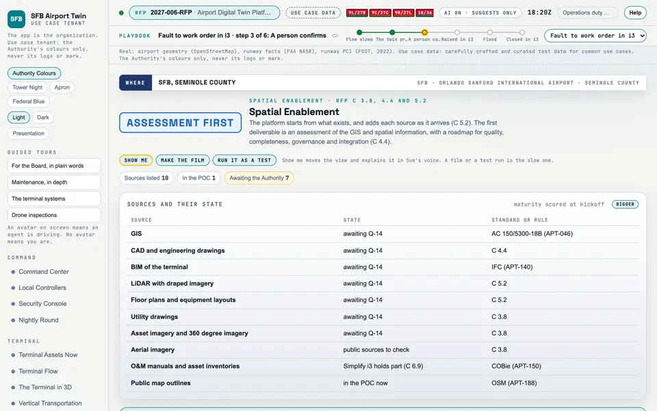
Picture: Headless capture of poc/index.html?v=spatial&m=light, as the proof of concept renders it, 1400 by 875 at 2x scale.
Screen · Proof of concept · Assets
Which maps, drawings and models the twin can use today, and what to add next.
- Sources
- Interchange
- Twin
- Screens
- Plan
- Kind
- Screen
- Status
- partly met, target
- Airport layer
- Screens: the POC story and the spines
- Airport area
- not linked
- System
- not linked
- Sensor type
- not linked
Open the screen · Open the detail
Level 2 of 3 This component, complete on its own. Its files, sources and tests are the detail below. Open the detail
Open this screen in the proof of concept
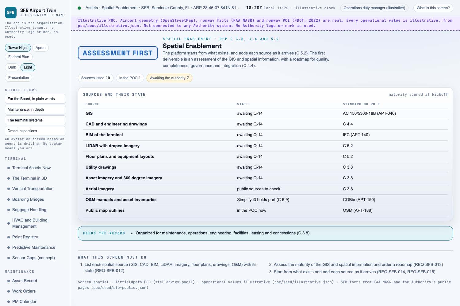 Capture of the screen: Spatial Enablement. Dark and light modes.
Narration line
It lists each spatial source (GIS, CAD, BIM, LiDAR, imagery, floor plans, drawings, O&M) with its state.
Source: poc/bearings/spatial.json, beat "What it shows"
- Group
- Assets
- Status as the app labels it
- Real
- Basis
- The maps and models the twin can use, from public sources.
What the screen must do (3)
- List each spatial source (GIS, CAD, BIM, LiDAR, imagery, floor plans, drawings, O&M) with its state (REQ-SFB-012)
- Assess the maturity of the GIS and spatial information and order a roadmap (REQ-SFB-013)
- Start from what exists and add each source as it arrives (REQ-SFB-014, REQ-SFB-015)
Requirements matrix rows that name this screen (8)
| Row | RFP section | Requirement | Status |
|---|
| M-011 | RFP 3, objective 5 | Configurable dashboards, spatial visualizations, workflows, analytics and reporting | partly met |
| M-025 | RFP 3, spatial | Incorporate GIS, CAD, BIM, LiDAR, imagery, floor plans, drawings, asset locations | partly met |
| M-059 | B ii | Show support for business value, simplicity, COTS, configuration first, systems of record, open integration, practical AI, spatial enablement | partly met |
| M-061 | B ii | Spatial approach for GIS, CAD, BIM, LiDAR, imagery, floor plans, drawings, asset locations, O&M | partly met |
| M-101 | C 3.8 | Spatial enablement across GIS, CAD, BIM, LiDAR, imagery, plans, drawings, utilities, O&M; organized for each user group | partly met |
| M-105 | C 4.4 | Incorporate spatial information; assess GIS maturity; roadmap for quality, completeness, governance | target |
| M-116 | C 5.2 | Incorporate GIS, CAD, BIM, LiDAR, plans, drawings, layouts, locations, O&M, imagery, CCTV and analytics | partly met |
| M-117 | C 5.2 | Do not require every source before implementation | partly met |
Requirement identifiers (4)
REQ-SFB-012, REQ-SFB-013, REQ-SFB-014, REQ-SFB-015